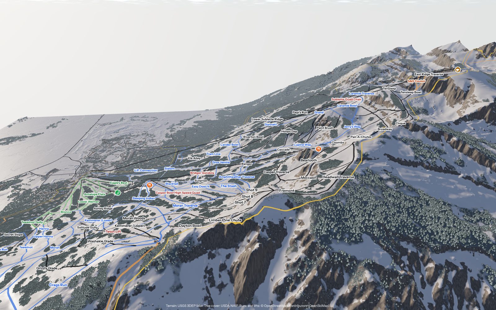
Hyper-real 3D trail maps
Nearly 800 ski areas across the US, Canada and Japan, mapped from 1-metre lidar: the terrain to the metre, the forest tree by tree, and every run and lift where it really is.
Here is what you can do with one.
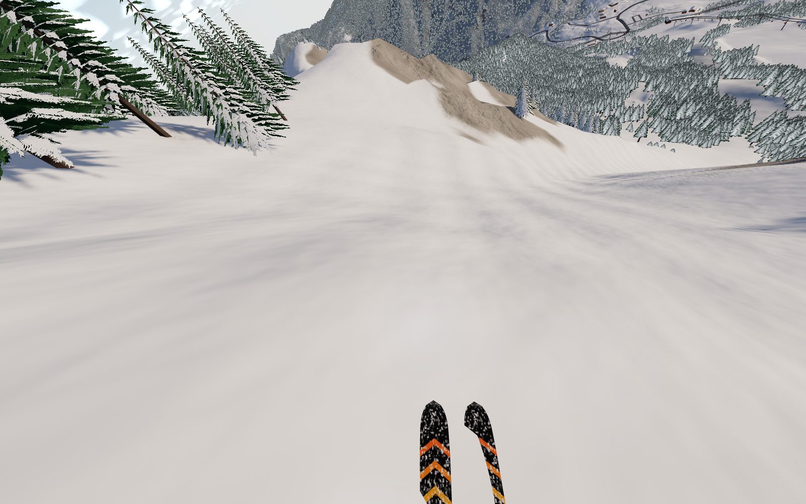
Learn the mountain before you visit
The run simulator puts you on every run, over your ski tips: the real pitch, the rolls and the trees, in the snow of the day. Ride it a few times and you know where it steepens, where it narrows and where to turn, before your first chair.
- Powder, groomers, spring snow or ice, with speed that builds the way it does on the real slope
- Look around from any spot before you commit
- Every run you ride is ticked off, here and in real life
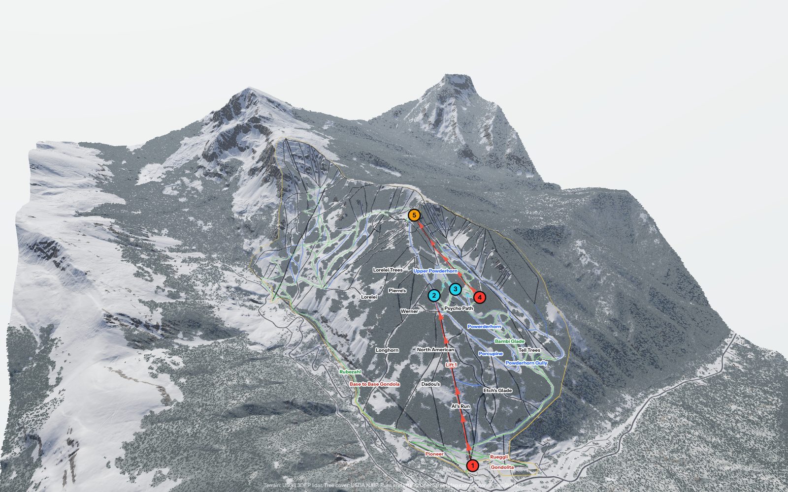
Ask the way. It's drawn on the snow.
Ask Snow Guide how to get anywhere and it answers step by step: which lifts to ride, which runs link up, the cat tracks, the bootpacks and the time it all takes, painted on the mountain.
- “The way to Highline Ridge without any blacks”
- “All the blues off Lift 4, then lunch”
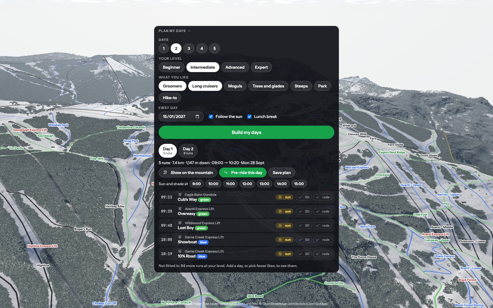
Plan your days around the sun
Tell it how you ski and what you like. It builds each day run by run, following the sun round the mountain, with lunch and the last chair, then you can pre-ride the lot.
- One day or five, for a first-timer or an expert
- Sunny slopes in the morning, out of the shadows by afternoon
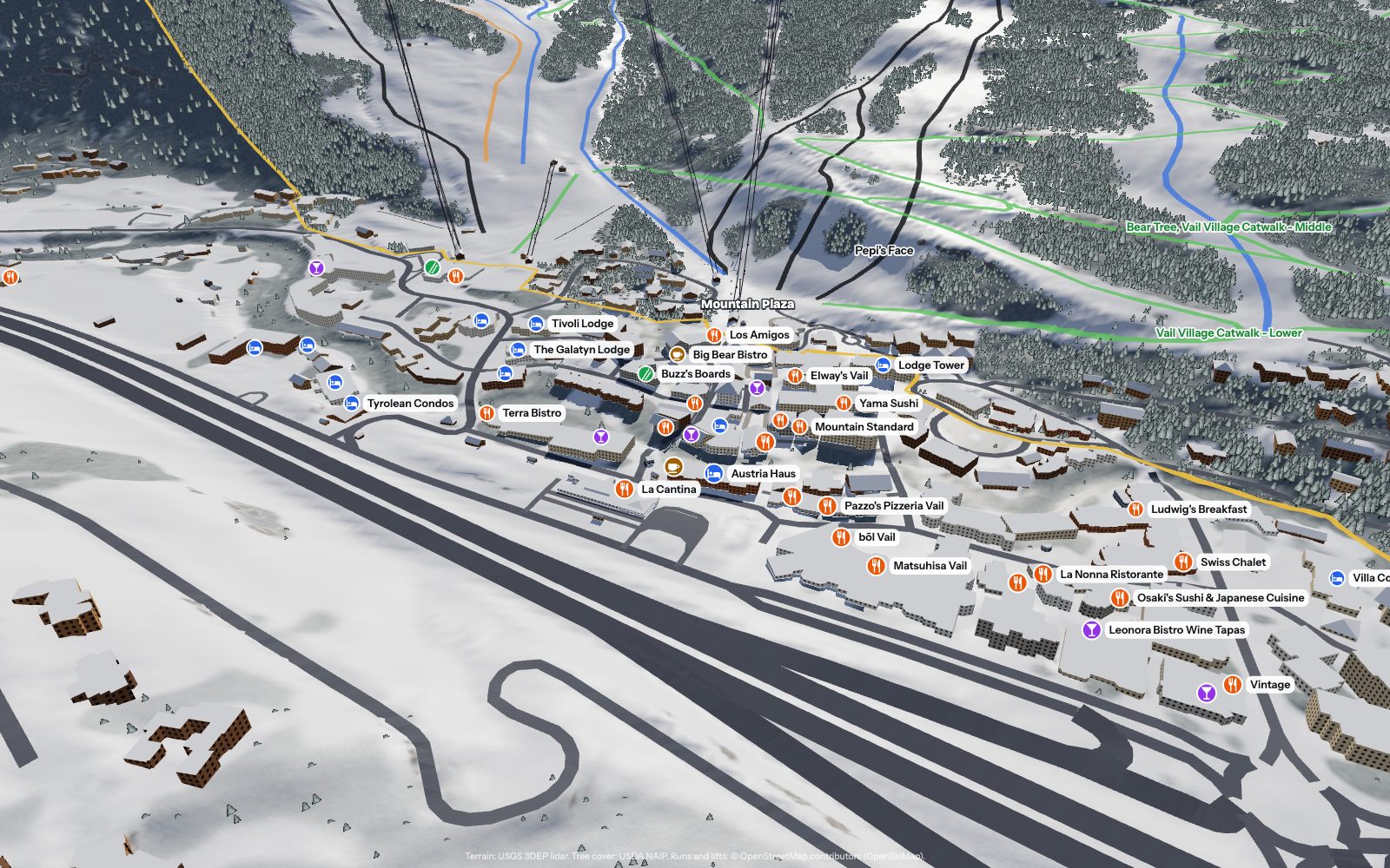
The village, open for business
Every café, bar, restaurant, lodge and rental shop, where it actually is, with the walk to the nearest lift, the website and the phone number.
- “Après bars near the gondola”
- “Ski back to our lodge from the top of Chair 4”
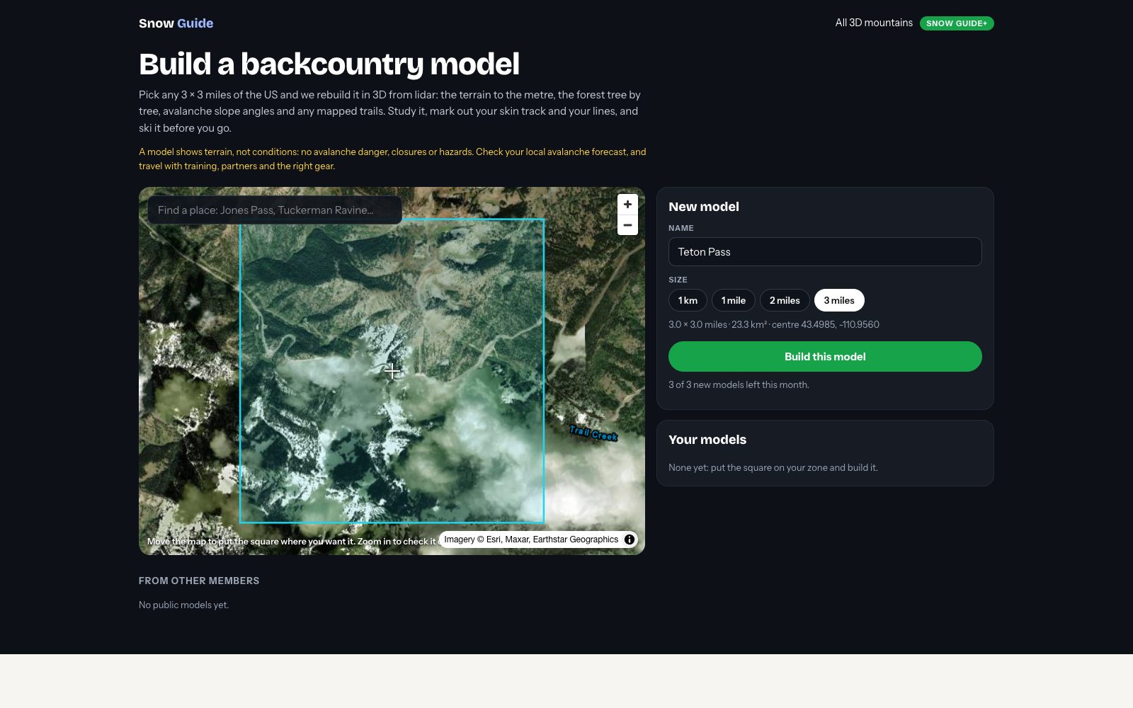
Build any backcountry zone
Put a square up to 3 × 3 miles anywhere in the US and we rebuild it from lidar in a few minutes: the terrain, the forest, avalanche slope angles and any mapped trails, ready to explore in 3D.
- Three new zones a month, kept in your account
- Publish your best ones to the backcountry gallery
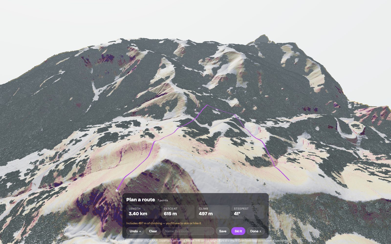
Map your skin track and your line
Click the snow to draw your route: you get its length, the climb, the descent and the steepest ground it crosses, over slope shading at 25, 30, 35 and 45 degrees. Save it, ski it, share it with your crew.
Swipe it
The same mountain, from the same camera: the free map's 3D terrain, and its hyper-real 3D trail map.
Start with your home mountain
Your home mountain is free with a confirmed Snow Guide account. Snow Guide+ unlocks every mountain, the backcountry builder and the premium Ask, for $10 a year.